Flight Trackers
Forecasts (Soaring)
Forecasts
NOAA Aviation MOS • Probabilities and Thresholds • KWVI • KPAO • KSQL • KTRK • KRNO
USAirNet MOS • KWVI • KSQL • KTRK • KRNO
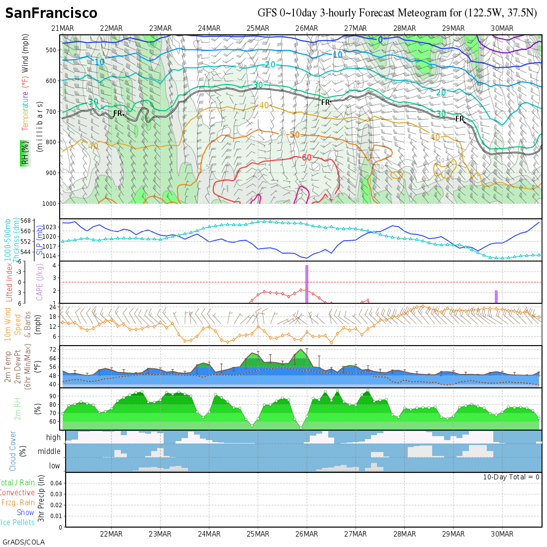
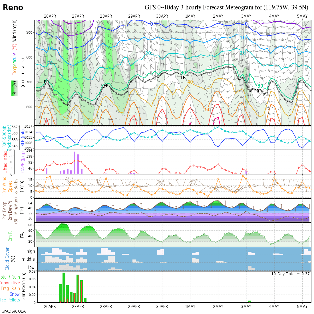
GFS Meteogram • San Francisco • Reno • All
Full Model Maps • CoD NexLab • COLA • COLA2 • MeteoBlue
General Forecasting Tools
Pivotal Precip, 1000-500 thickness General Flying Overview, highs/lows
Graphical Forecasts for Aviation: Obs
Graphical Forecast for Aviation: Ceiling and Vis
Graphical Forecast for Aviation: Prog
Vertical Maps
Discussion
Monterey • Hanford • Sacramento • Reno • Las Vegas • Los Angeles • Elko
Weather.gov 7-day
Soquel • Donner Summit • Truckee
Wind Visualization and Satellite Imagry
Satellite
GOES-West • Visible Loop • Infrared Loop
Smoke
HRRR Smoke | • RAP Smoke
Obserations and Weather Stations
Web Cameras
Atmospheric Equivalents
| MB | Inches | ATMs | Elev Ft |
|---|---|---|---|
| 1013 | 29.9 | 1.0 | 0 |
| 977 | 28.9 | 1.0 | 1000 |
| 843 | 24.9 | 0.8 | 5000 |
| 697 | 20.6 | 0.7 | 10000 |
| 572 | 16.9 | 0.6 | 15000 |
| 466 | 13.8 | 0.5 | 20000 |
| 377 | 11.1 | 0.4 | 25000 |
| 301 | 8.9 | 0.3 | 30000 |